The April 1 Snow and Water Supply Bulletin is scheduled to be released by the BC River Forecast Centre on April 10. This is considered the primary bulletin for historic seasonal snowpack comparison. The official snow basin indices are calculated in the bulletin.
The snow basin indices are a modelled value, based on the Okanagan automated snow survey stations, and a number of manually-collected measurements from snow courses.
Find a helpful video on the measurement process here:
The most recent estimate of our snowpack (March 15) puts the Okanagan at 69%. This is an unofficial estimate, based on averaging information from the snow pillows.
The forecast for most of this week is sun and warm temperatures. In general, these conditions do not bode well for continued accumulation in the near term.
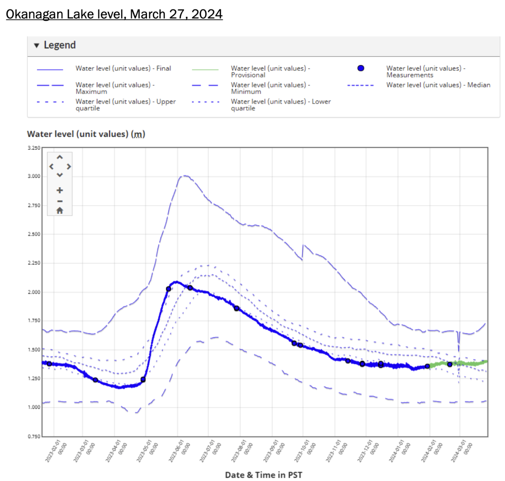
Provincial staff have been releasing as little water as possible from Okanagan Lake (maintaining minimum flows in the Okanagan River channel), using the lake as a storage reservoir—anticipating the low snow pack and an early, less-volume-than-normal freshet. Okanagan stream flow (hydrometric) measurements are also signaling the beginning of an early freshet.
As of February 26, Okanagan automated snow pillows remain at below the 25th percentile for their historical records. The Similkameen snow pillow at Blackwall peak is also extremely low at 3% of the historical percentile.
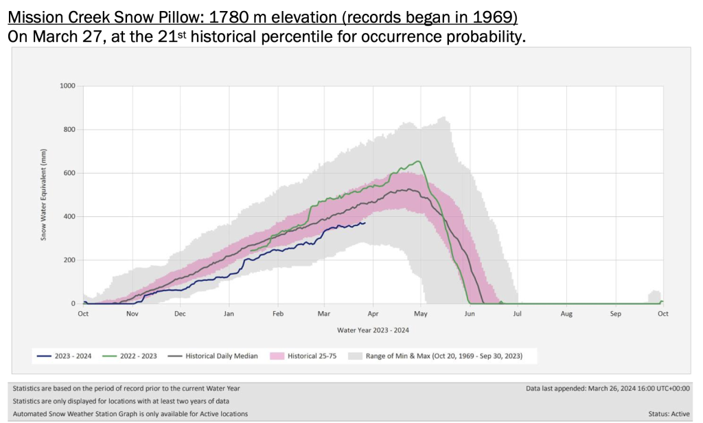
Mission Creek Snow Pillow: 1780 m elevation (records began in 1969)
On March 27, at the 21st historical percentile for occurrence probability.
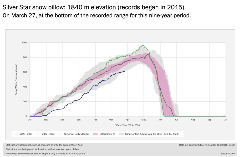
Silver Star snow pillow: 1840 m elevation (records began in 2015)
On March 27, at the bottom of the recorded range for this nine-year period.
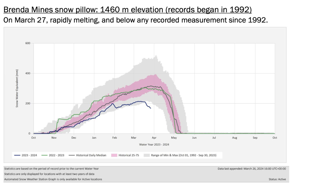
Brenda Mines snow pillow: 1460 m elevation (records began in 1992)
On March 27, rapidly melting, and below any recorded measurement since 1992.